Geolocate

Dover Base topographic map

Click on the map to display elevation.

About this map

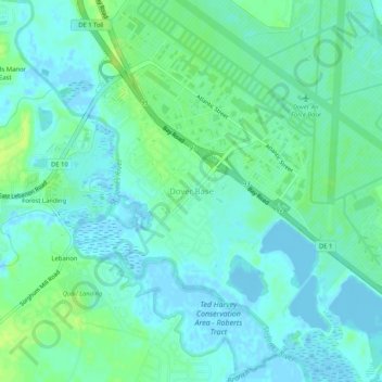
Name: Dover Base topographic map, elevation, terrain.

Location: Dover Base, Kent County, Delaware, 19902, United States (39.09855 -75.50335 39.13855 -75.46335)

Average elevation: 16 ft

Minimum elevation: -23 ft

Maximum elevation: 43 ft

Other topographic maps

Click on a map to view its topography, its elevation and its terrain.

Dover

United States > Delaware > Kent County

Average elevation: 33 ft

Magnolia

United States > Delaware > Kent County

Average elevation: 23 ft

Smyrna

United States > Delaware > Kent County

Average elevation: 33 ft

Camden

United States > Delaware > Kent County

Average elevation: 43 ft

Bowers

United States > Delaware > Kent County

Average elevation: 0 ft

Dover

United States > Delaware > Kent County

Average elevation: 33 ft

Harrington

United States > Delaware > Kent County

Average elevation: 56 ft

Clayton

United States > Delaware > Kent County

Average elevation: 43 ft

Harrington

United States > Delaware > Kent County

Average elevation: 56 ft

Camden

United States > Delaware > Kent County

Average elevation: 43 ft

Cheswold

United States > Delaware > Kent County > Cheswold

Average elevation: 43 ft

Lake Bernard

United States > Delaware > Kent County > Florence

Average elevation: 13 ft

Cheswold

United States > Delaware > Kent County

Average elevation: 43 ft

Gear up for your next adventure:

🪄Magnetic Compass - Accurate compass for navigation
👓Polarized Sunglasses - Outdoor sunglasses for glare reduction
🧢Sun Protection Hats - Wide-brimmed and UPF-rated hats for high-altitude sun safety
Camping Coffee Makers - Enjoy premium coffee at the summit or campsite
🧭Orienteering Set - Complete compass and map reading kit

As an Amazon Associate, this site earns from qualifying purchases at no extra cost to you.