Geolocate

Harrington topographic map

Click on the map to display elevation.

About this map

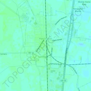
Name: Harrington topographic map, elevation, terrain.

Location: Harrington, Kent County, Delaware, 19952, United States (38.90579 -75.59069 38.93679 -75.55149)

Average elevation: 56 ft

Minimum elevation: 46 ft

Maximum elevation: 66 ft

Other topographic maps

Click on a map to view its topography, its elevation and its terrain.

Lebanon

United States > Delaware > Kent County > Highland Acres

Average elevation: 23 ft

Vernon

United States > Delaware > Kent County

Average elevation: 52 ft

Dover Base

United States > Delaware > Kent County

Average elevation: 16 ft

Lebanon

United States > Delaware > Kent County > Highland Acres

Average elevation: 23 ft

Holletts Corners

United States > Delaware > Kent County

Average elevation: 69 ft

Woodstock Court

United States > Delaware > Kent County > Dover

Average elevation: 43 ft

Marydel

United States > Delaware > Kent County

Average elevation: 62 ft

Lake Bernard

United States > Delaware > Kent County > Florence

Average elevation: 13 ft

Gear up for your next adventure:

🛠️Outdoor Gear Repair Kit - Essential tools to fix gear on the trail
🧢Sun Protection Hats - Wide-brimmed and UPF-rated hats for high-altitude sun safety
🎒Gear Packing Cubes - Organize your backpack efficiently
🔥Camping Stove - Portable stove for camping and backcountry cooking
📶Satellite Messenger - Communication device off‑grid

As an Amazon Associate, this site earns from qualifying purchases at no extra cost to you.