Geolocate

福海街道 topographic map

Interactive map

Click on the map to display elevation.

About this map

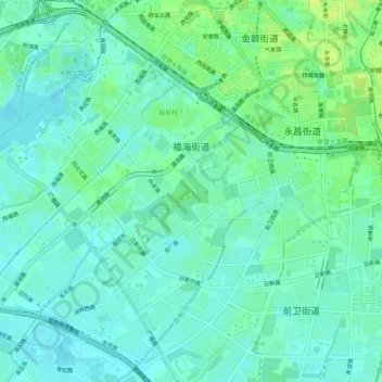
Name: 福海街道 topographic map, elevation, terrain.

Location: 福海街道, 西山区, 昆明市, 云南省, 中国 (24.99062 102.64368 25.03237 102.69641)

Average elevation: 6,207 ft

Minimum elevation: 6,184 ft

Maximum elevation: 6,253 ft

Other topographic maps

Click on a map to view its topography, its elevation and its terrain.

西山风景区

中国 > 云南省 > 西山区

西山风景区, 西山区, 昆明市, 云南省, 中国

Average elevation: 6,673 ft

大观公园

中国 > 云南省 > 西山区

大观公园, 棕树营街道, 西山区, 昆明市, 云南省, 中国

Average elevation: 6,207 ft

碧鸡街道

中国 > 云南省 > 西山区

碧鸡街道, 西山区, 昆明市, 云南省, 中国

Average elevation: 6,444 ft

马街街道

中国 > 云南省 > 西山区

马街街道, 西山区, 昆明市, 云南省, 中国

Average elevation: 6,434 ft

金碧街道

中国 > 云南省 > 西山区

金碧街道, 西山区, 云南省, 中国

Average elevation: 6,224 ft

西苑街道

中国 > 云南省 > 西山区 > 西苑街道

西苑街道, 西山区, 昆明市, 云南省, 中国

Average elevation: 6,211 ft

普渡河

中国 > 云南省 > 西山区 > 海口街道

普渡河, 海口街道, 西山区, 昆明市, 云南省, 中国

Average elevation: 6,352 ft