
南岸区 topographic map
Interactive map
Click on the map to display elevation.
About this map
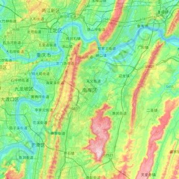
Name: 南岸区 topographic map, elevation, terrain.
Location: 南岸区, 重庆市主城都市区, 重庆市, 中国 (29.34287 106.48247 29.66287 106.80247)
Average elevation: 1,030 ft
Minimum elevation: 479 ft
Maximum elevation: 2,382 ft
Other topographic maps
Click on a map to view its topography, its elevation and its terrain.