
涂山镇 topographic map
Interactive map
Click on the map to display elevation.
About this map
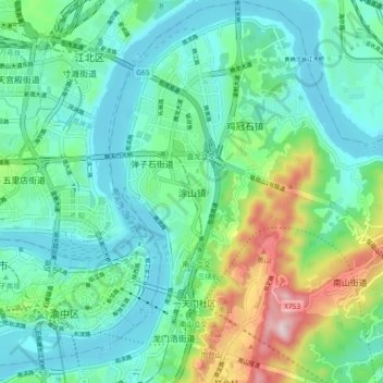
Name: 涂山镇 topographic map, elevation, terrain.
Location: 涂山镇, 南岸区, 重庆市, 400010, 中国 (29.54080 106.55600 29.62080 106.63600)
Average elevation: 886 ft
Minimum elevation: 492 ft
Maximum elevation: 2,136 ft
Other topographic maps
Click on a map to view its topography, its elevation and its terrain.