Geolocate

石家河 topographic map

Interactive map

Click on the map to display elevation.

About this map

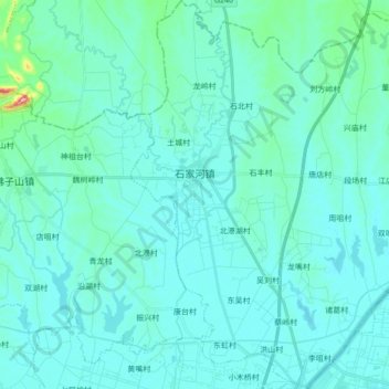
Name: 石家河 topographic map, elevation, terrain.

Location: 石家河, 天门市, 湖北省, 中国 (30.67702 113.05475 30.82490 113.17989)

Average elevation: 125 ft

Minimum elevation: 72 ft

Maximum elevation: 577 ft

Other topographic maps

Click on a map to view its topography, its elevation and its terrain.

东湖

中国 > 湖北省 > 天门市

东湖, 竟陵, 天门市, 湖北省, 431700, 中国

Average elevation: 98 ft

天门山

中国 > 湖北省 > 天门市

天门山, 天门市, 湖北省, 中国

Average elevation: 187 ft

岳口

中国 > 湖北省 > 天门市

岳口, 天门市, 湖北省, 中国

Average elevation: 98 ft

前河村

中国 > 湖北省 > 天门市

前河村, 天门市, 湖北省, 中国

Average elevation: 98 ft

同乐村

中国 > 湖北省 > 天门市

同乐村, 天门市, 湖北省, 中国

Average elevation: 95 ft

九真村

中国 > 湖北省 > 天门市

九真村, 天门市, 湖北省, 中国

Average elevation: 102 ft

天门市

中国 > 湖北省 > 天门市

天门市, 湖北省, 中国

Average elevation: 105 ft