
梨树县 topographic map
Interactive map
Click on the map to display elevation.
About this map
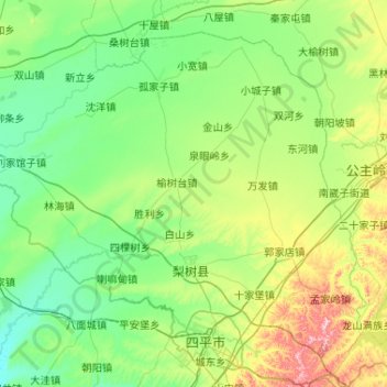
Name: 梨树县 topographic map, elevation, terrain.
Location: 梨树县, 四平市, 吉林省, 中国 (43.13951 123.75948 43.76967 124.79595)
Average elevation: 571 ft
Minimum elevation: 331 ft
Maximum elevation: 1,601 ft
Other topographic maps
Click on a map to view its topography, its elevation and its terrain.