Geolocate

Milners Corner topographic map

Click on the map to display elevation.

About this map

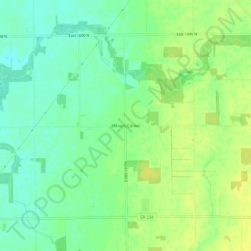
Name: Milners Corner topographic map, elevation, terrain.

Location: Milners Corner, Hancock County, Indiana, United States (39.89638 -85.71184 39.93638 -85.67184)

Average elevation: 928 ft

Minimum elevation: 896 ft

Maximum elevation: 958 ft

Hancock County trails, hiking, mountain biking, running and outdoor activities

Other topographic maps

Click on a map to view its topography, its elevation and its terrain.

Wilkinson

United States > Indiana > Hancock County

Average elevation: 1,007 ft

Spring Lake

United States > Indiana > Hancock County

Average elevation: 850 ft

New Palestine

United States > Indiana > Hancock County

Average elevation: 830 ft

Cumberland

United States > Indiana > Hancock County

Average elevation: 856 ft

Fortville

United States > Indiana > Hancock County

Average elevation: 863 ft

Gear up for your next adventure:

👟Trail Running Shoes - Lightweight shoes for trail runners
😴Insulated Sleeping Pads - Compact and warm pads for high-elevation camping
📶Vehicle Signal Boosters - Improve reception in rural areas while driving to trailheads
🔦Compact Flashlight - Reliable flashlight for emergencies
🔋Solar Power Banks - Keep your GPS and phone charged in remote wilderness areas

As an Amazon Associate, this site earns from qualifying purchases at no extra cost to you.