
Danube topographic map
Click on the map to display elevation.
About this map
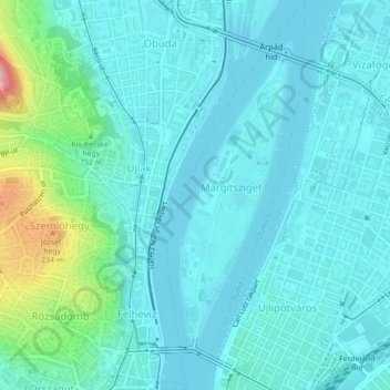
Name: Danube topographic map, elevation, terrain.
Location: Danube, 5th district, Budapest, Central Hungary, 1000, Hungary (47.51160 19.04058 47.54175 19.05635)
Average elevation: 410 ft
Minimum elevation: 318 ft
Maximum elevation: 889 ft
Other topographic maps
Click on a map to view its topography, its elevation and its terrain.