Geolocate

Torrance topographic map

Click on the map to display elevation.

About this map

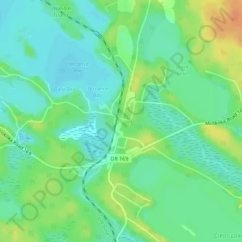
Name: Torrance topographic map, elevation, terrain.

Location: Torrance, Muskoka Lakes Township, District Municipality of Muskoka, Muskoka District, Central Ontario, Ontario, Canada (44.98553 -79.57924 45.00553 -79.55924)

Average elevation: 771 ft

Minimum elevation: 728 ft

Maximum elevation: 846 ft

Other topographic maps

Click on a map to view its topography, its elevation and its terrain.

Gear up for your next adventure:

🚗GPS Dash Cams - Record your scenic drives through mountain passes and canyons
📡Handheld GPS Device - Reliable handheld GPS for outdoor navigation
🧼Biodegradable Camping Soap - Eco‑friendly soap for outdoor hygiene
🧢Outdoor Hiking Hat - Sun protection hat for outdoor explorers
🌲Outdoor Survival Books - Best books on survival skills

As an Amazon Associate, this site earns from qualifying purchases at no extra cost to you.