
Lilburn topographic map
Click on the map to display elevation.
About this map
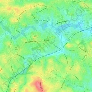
Name: Lilburn topographic map, elevation, terrain.
Location: Lilburn, Gwinnett County, Georgia, 30047, United States (33.86505 -84.16771 33.90904 -84.10881)
Average elevation: 955 ft
Minimum elevation: 850 ft
Maximum elevation: 1,122 ft
Gwinnett County trails, hiking, mountain biking, running and outdoor activities
Other topographic maps
Click on a map to view its topography, its elevation and its terrain.
Yellow River Post Office Site
United States > Georgia > Gwinnett County > Lilburn
Average elevation: 902 ft
Bogan Park
United States > Georgia > Gwinnett County > Buford > Springlake Estates
Average elevation: 1,161 ft
Pine Ridge Country Club Estates
United States > Georgia > Gwinnett County > Lawrenceville
Average elevation: 1,060 ft