
Auli topographic map
Click on the map to display elevation.
About this map
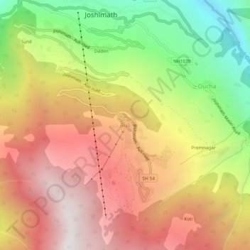
Name: Auli topographic map, elevation, terrain.
Location: Auli, Joshimath Tehsil, Chamoli, Uttarakhand, India (30.51779 79.54572 30.55779 79.58572)
Average elevation: 7,999 ft
Minimum elevation: 4,797 ft
Maximum elevation: 10,696 ft
Other topographic maps
Click on a map to view its topography, its elevation and its terrain.
Valley of Flowers National Park
India > Uttarakhand > Joshimath Tehsil > Ghangaria
Average elevation: 15,112 ft
Valley of Flowers National Park
India > Uttarakhand > Joshimath Tehsil > Ghangaria
Average elevation: 15,112 ft