
Rungwe topographic map
Interactive map
Click on the map to display elevation.
About this map
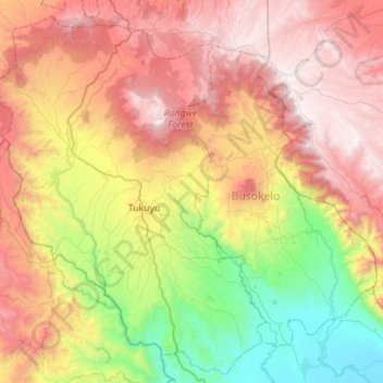
Name: Rungwe topographic map, elevation, terrain.
Location: Rungwe, Mbeya, Southern Highlands Zone, Tanzania (-9.50949 33.43816 -8.95793 33.99059)
Average elevation: 5,217 ft
Minimum elevation: 1,555 ft
Maximum elevation: 9,610 ft
Other topographic maps
Click on a map to view its topography, its elevation and its terrain.