
Mbeya topographic map
Interactive map
Click on the map to display elevation.
About this map
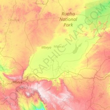
Name: Mbeya topographic map, elevation, terrain.
Location: Mbeya, Southern Highlands Zone, Tanzania (-9.33402 33.04437 -7.52528 35.00074)
Average elevation: 4,731 ft
Minimum elevation: 1,916 ft
Maximum elevation: 9,675 ft
Other topographic maps
Click on a map to view its topography, its elevation and its terrain.