
Selma topographic map
Click on the map to display elevation.
About this map
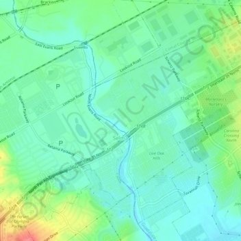
Name: Selma topographic map, elevation, terrain.
Location: Selma, Bexar County, Texas, United States (29.56844 -98.34165 29.60764 -98.29056)
Average elevation: 781 ft
Minimum elevation: 715 ft
Maximum elevation: 948 ft
Bexar County trails, hiking, mountain biking, running and outdoor activities
Other topographic maps
Click on a map to view its topography, its elevation and its terrain.