
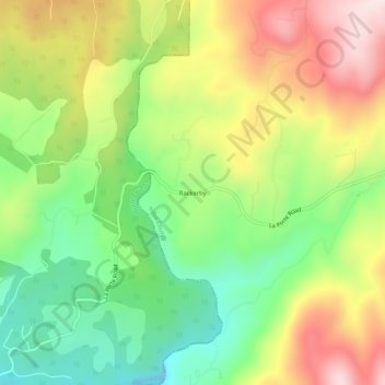
Rackerby topographic map
Click on the map to display elevation.
About this map
Name: Rackerby topographic map, elevation, terrain.
Location: Rackerby, Yuba County, California, 95972, United States (39.42001 -121.35790 39.46001 -121.31790)
Average elevation: 1,539 ft
Minimum elevation: 906 ft
Maximum elevation: 2,329 ft
Yuba County trails, hiking, mountain biking, running and outdoor activities
Other topographic maps
Click on a map to view its topography, its elevation and its terrain.
Beale AFB
United States > California > Yuba County
On 15 October 1964, the Department of Defense announced that Beale would be the home of the new, supersonic reconnaissance aircraft, the SR-71 Blackbird. The provisional 4200th Strategic Reconnaissance Wing (4200 SRW) activated on 1 January 1965 in preparation for the realignment, and the new wing received its…
Average elevation: 226 ft