
Make a donation
Gear up for your next adventure:
As an Amazon Associate, this site earns from qualifying purchases at no extra cost to you.
Mount Curran topographic map
Click on the map to display elevation.
Make a donation
Gear up for your next adventure:
As an Amazon Associate, this site earns from qualifying purchases at no extra cost to you.
About this map
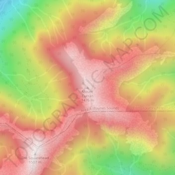
Name: Mount Curran topographic map, elevation, terrain.
Average elevation: 3,747 ft
Minimum elevation: 1,965 ft
Maximum elevation: 4,928 ft
Make a donation
Gear up for your next adventure:
As an Amazon Associate, this site earns from qualifying purchases at no extra cost to you.
Other topographic maps
Click on a map to view its topography, its elevation and its terrain.
Denman Island
Canada > British Columbia > Comox Valley Regional District > Area A (Baynes Sound)
Average elevation: 118 ft
Hornby Island
Canada > British Columbia > Comox Valley Regional District > Area A (Baynes Sound)
Average elevation: 89 ft
Tsable Lakes Woodlands
Canada > British Columbia > Comox Valley Regional District > Area A (Baynes Sound)
Average elevation: 1,824 ft
Rosewall Creek Provincial Park
Canada > British Columbia > Comox Valley Regional District > Area A (Baynes Sound)
Average elevation: 128 ft
Make a donation
Gear up for your next adventure:
As an Amazon Associate, this site earns from qualifying purchases at no extra cost to you.
Beaufort Range
Canada > British Columbia > Comox Valley Regional District > Area A (Baynes Sound)
Average elevation: 1,427 ft