Geolocate

Exeter topographic map

Click on the map to display elevation.

About this map

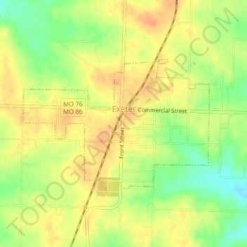
Name: Exeter topographic map, elevation, terrain.

Location: Exeter, Barry County, Missouri, 65647, United States (36.66359 -93.95480 36.67769 -93.92940)

Average elevation: 1,529 ft

Minimum elevation: 1,447 ft

Maximum elevation: 1,578 ft

Barry County trails, hiking, mountain biking, running and outdoor activities

Other topographic maps

Click on a map to view its topography, its elevation and its terrain.

Golden

United States > Missouri > Barry County

Average elevation: 1,070 ft

Ridgley

United States > Missouri > Barry County

Average elevation: 1,417 ft

Corsicana

United States > Missouri > Barry County

Average elevation: 1,365 ft

Pioneer

United States > Missouri > Barry County

Average elevation: 1,263 ft

Jenkins

United States > Missouri > Barry County

Average elevation: 1,178 ft

Madry

United States > Missouri > Barry County

Average elevation: 1,509 ft

Cato

United States > Missouri > Barry County

Average elevation: 1,152 ft

Reed Mountain

United States > Missouri > Barry County

Average elevation: 1,447 ft

Gear up for your next adventure:

🩳Quick‑Dry Hiking Shorts - Comfortable and quick‑dry shorts for summer hiking
🥾Women's Hiking Boots - Top-rated trail boots with ankle support and superior grip
🧭Compass with Lanyard - Easy‑carry compass for navigation
🕶️Glacier Sunglasses - Side shields to protect eyes from high-altitude snow glare
🌐World Map Poster - Decorative world maps with topographic info

As an Amazon Associate, this site earns from qualifying purchases at no extra cost to you.