Geolocate

Chehalem topographic map

Interactive map

Click on the map to display elevation.

About this map

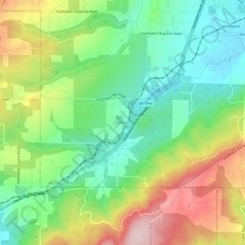
Name: Chehalem topographic map, elevation, terrain.

Location: Chehalem, Washington County, Oregon, 97140, United States (45.30797 -122.90969 45.34797 -122.86969)

Average elevation: 594 ft

Minimum elevation: 180 ft

Maximum elevation: 1,250 ft

Washington County trails, hiking, mountain biking, running and outdoor activities

Other topographic maps

Click on a map to view its topography, its elevation and its terrain.

Aloha

United States > Oregon > Washington County

Average elevation: 217 ft

North Plains

United States > Oregon > Washington County

Average elevation: 187 ft

Banks

United States > Oregon > Washington County

Average elevation: 230 ft

Rock Creek

United States > Oregon > Washington County

Average elevation: 213 ft

Vose

United States > Oregon > Washington County > Beaverton

Average elevation: 230 ft

King City

United States > Oregon > Washington County

Average elevation: 243 ft

Gaston

United States > Oregon > Washington County

Average elevation: 217 ft