
塔山 topographic map
Interactive map
Click on the map to display elevation.
About this map
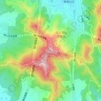
Name: 塔山 topographic map, elevation, terrain.
Location: 塔山, 烟台市, 山东省, 264000, 中国 (37.50289 121.39039 37.50299 121.39049)
Average elevation: 604 ft
Minimum elevation: 184 ft
Maximum elevation: 1,280 ft
Other topographic maps
Click on a map to view its topography, its elevation and its terrain.