
龙港区 topographic map
Interactive map
Click on the map to display elevation.
About this map
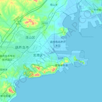
Name: 龙港区 topographic map, elevation, terrain.
Location: 龙港区, 葫芦岛市, 辽宁省, 125000, 中国 (40.65394 120.73733 40.83100 121.03565)
Average elevation: 59 ft
Minimum elevation: -33 ft
Maximum elevation: 801 ft
Other topographic maps
Click on a map to view its topography, its elevation and its terrain.