Geolocate

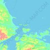
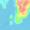
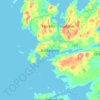
Burgeo topographic map

Click on the map to display elevation.

About this map

Name: Burgeo topographic map, elevation, terrain.

Location: Burgeo, Newfoundland, Newfoundland and Labrador, A0N 2H0, Canada (47.54705 -57.68554 47.65119 -57.54415)

Average elevation: 39 ft

Minimum elevation: -7 ft

Maximum elevation: 489 ft

Other topographic maps

Click on a map to view its topography, its elevation and its terrain.
Bell Island

Canada > Newfoundland and Labrador

Average elevation: 30 ft

Labrador

Canada > Newfoundland and Labrador

Average elevation: 2,211 ft

Englee

Canada > Newfoundland and Labrador > Englee

Average elevation: 112 ft

Highway 220

Canada > Newfoundland and Labrador

Average elevation: 26 ft

Whitbourne

Canada > Newfoundland and Labrador > Whitbourne

Average elevation: 230 ft

Grosse Point

Canada > Newfoundland and Labrador

Average elevation: 82 ft
Mount Caubvick

Canada > Newfoundland and Labrador

Average elevation: 4,173 ft

Ragged Point

Canada > Newfoundland and Labrador

Average elevation: 20 ft

Bridgeport

Canada > Newfoundland and Labrador

Average elevation: 72 ft

Monroe

Canada > Newfoundland and Labrador

Average elevation: 135 ft

Smokey

Canada > Newfoundland and Labrador > Smokey

Average elevation: 46 ft

Tims Hill

Canada > Newfoundland and Labrador

Average elevation: 413 ft

Gear up for your next adventure:

🖼️Topo Map Wall Art - Decorative topographic prints of famous peaks and regions
🚁Photography Drones - Capture stunning aerial views of landforms and topography
🧣Merino Neck Gaiters - Multi-functional headwear for wind and sun protection
🧺Microfiber Travel Towels - Compact and fast-drying towels for trail use
🔭Stargazing Telescopes - Perfect for camping in low-light pollution areas shown on maps

As an Amazon Associate, this site earns from qualifying purchases at no extra cost to you.