Geolocate

Hansen topographic map

Click on the map to display elevation.

About this map

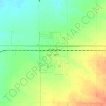
Name: Hansen topographic map, elevation, terrain.

Location: Hansen, Twin Falls County, Idaho, United States (42.52606 -114.30658 42.53688 -114.29614)

Average elevation: 4,026 ft

Minimum elevation: 3,953 ft

Maximum elevation: 4,101 ft

Twin Falls County trails, hiking, mountain biking, running and outdoor activities

Other topographic maps

Click on a map to view its topography, its elevation and its terrain.

Rogerson

United States > Idaho > Twin Falls County

Average elevation: 4,915 ft

Gear up for your next adventure:

💧Water Purification System - Clean water on the trail with reliable purifiers
🧦Merino Wool Socks - Moisture-wicking, blister-preventing socks for long treks
🧭Orienteering Set - Complete compass and map reading kit
🧢Outdoor Hiking Hat - Sun protection hat for outdoor explorers
🦺Reflective Outdoor Gear - Safety gear for low‑light conditions

As an Amazon Associate, this site earns from qualifying purchases at no extra cost to you.