
Make a donation
Gear up for your next adventure:
As an Amazon Associate, this site earns from qualifying purchases at no extra cost to you.
Dilworth topographic map
Click on the map to display elevation.
Make a donation
Gear up for your next adventure:
As an Amazon Associate, this site earns from qualifying purchases at no extra cost to you.
About this map
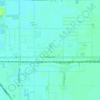
Name: Dilworth topographic map, elevation, terrain.
Location: Dilworth, Clay County, Minnesota, 56529, United States (46.86932 -96.72573 46.89099 -96.65236)
Average elevation: 912 ft
Minimum elevation: 902 ft
Maximum elevation: 938 ft
Clay County trails, hiking, mountain biking, running and outdoor activities
Make a donation
Gear up for your next adventure:
As an Amazon Associate, this site earns from qualifying purchases at no extra cost to you.
Other topographic maps
Click on a map to view its topography, its elevation and its terrain.
Make a donation
Gear up for your next adventure:
As an Amazon Associate, this site earns from qualifying purchases at no extra cost to you.
confluence of Red River of the North and Buffalo River
United States > Minnesota > Clay County
Average elevation: 879 ft