Geolocate

Baker topographic map

Click on the map to display elevation.

About this map

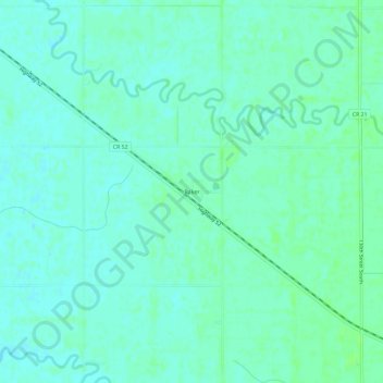
Name: Baker topographic map, elevation, terrain.

Location: Baker, Clay County, Minnesota, United States (46.69302 -96.57202 46.73302 -96.53202)

Average elevation: 938 ft

Minimum elevation: 925 ft

Maximum elevation: 951 ft

Clay County trails, hiking, mountain biking, running and outdoor activities

Other topographic maps

Click on a map to view its topography, its elevation and its terrain.

Sabin

United States > Minnesota > Clay County

Sabin is mostly south under U.S. Route 52 and the shortline railway owned by Otter Tail Valley Railroad Company that runs parallel to Route 52. According to the United States Census Bureau, the city of Sabin has an area of 0.35 square miles (0.91 km2), all land. The elevation is approximately 929 feet.

Average elevation: 925 ft

Hitterdal

United States > Minnesota > Clay County

Average elevation: 1,243 ft

Hitterdahl WMA

United States > Minnesota > Clay County

Average elevation: 1,243 ft

Dilworth

United States > Minnesota > Clay County

Average elevation: 912 ft

Comstock

United States > Minnesota > Clay County

Average elevation: 922 ft

Glyndon

United States > Minnesota > Clay County

Average elevation: 925 ft

Felton

United States > Minnesota > Clay County

Average elevation: 915 ft

Ulen

United States > Minnesota > Clay County

Average elevation: 1,155 ft

Gear up for your next adventure:

🪄Magnetic Compass - Accurate compass for navigation
🎒Hydration Pack - Hands‑free water reservoir for long hikes
🎒Gear Packing Cubes - Organize your backpack efficiently
🔌Solar Panel Charger - Charge gear sustainably outdoors
📌Outdoor GPS Map App - Apps and devices for digital topographic navigation

As an Amazon Associate, this site earns from qualifying purchases at no extra cost to you.