Geolocate

Kobala topographic map

Click on the map to display elevation.

About this map

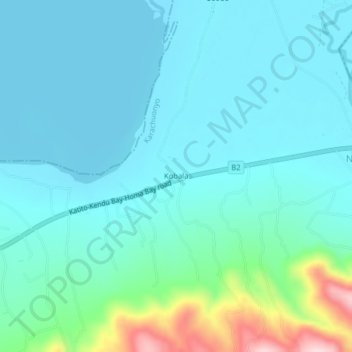
Name: Kobala topographic map, elevation, terrain.

Location: Kobala, Homa Bay County, Nyanza, 40301, Kenya (-0.37105 34.74638 -0.33105 34.78638)

Average elevation: 3,868 ft

Minimum elevation: 3,711 ft

Maximum elevation: 4,649 ft

Other topographic maps

Click on a map to view its topography, its elevation and its terrain.

Karachuonyo

Kenya > Homa Bay County

Average elevation: 4,006 ft

Gear up for your next adventure:

🪶Trail Camera - Capture wildlife on your hikes
🔋Rechargeable Batteries - Power up your outdoor devices
🧤Tactile Hiking Gloves - Keep hands warm while operating GPS and smartphone screens
🛰️Satellite Messengers - Emergency SOS and two-way messaging for off-grid adventures
🥩Freeze-Dried Meals - Nutritious and lightweight food for remote expeditions

As an Amazon Associate, this site earns from qualifying purchases at no extra cost to you.