Geolocate

Calmar topographic map

Click on the map to display elevation.

About this map

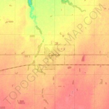
Name: Calmar topographic map, elevation, terrain.

Location: Calmar, Division No. 11, Alberta, T0C 0V0, Canada (53.22511 -113.84556 53.30511 -113.76556)

Average elevation: 2,398 ft

Minimum elevation: 2,264 ft

Maximum elevation: 2,454 ft

Other topographic maps

Click on a map to view its topography, its elevation and its terrain.

Oak Hills

Canada > Alberta > Division No. 11

Average elevation: 2,238 ft

Westridge

Canada > Alberta > Division No. 11

Average elevation: 2,195 ft

Rutherford

Canada > Alberta > Division No. 11 > Edmonton

Average elevation: 2,270 ft

King Edward Park

Canada > Alberta > Division No. 11 > Edmonton

Average elevation: 2,201 ft

Starling

Canada > Alberta > Division No. 11

Average elevation: 2,224 ft

Highlands

Canada > Alberta > Division No. 11 > Edmonton

Average elevation: 2,136 ft

Newton

Canada > Alberta > Division No. 11 > Edmonton

Average elevation: 2,156 ft

Gear up for your next adventure:

🧭Map Reading Tools - Tools and kits for map navigation
🥩Freeze-Dried Meals - Nutritious and lightweight food for remote expeditions
🍳Camping Cook Set - Complete cookware for outdoor meals
🏥Hiking First Aid Kits - Comprehensive medical kits for remote trail injuries
🛶Inflatable Kayak - Portable kayak for rivers, lakes, and expeditions

As an Amazon Associate, this site earns from qualifying purchases at no extra cost to you.