Geolocate

Ottone topographic map

Click on the map to display elevation.

About this map

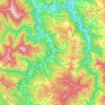
Name: Ottone topographic map, elevation, terrain.

Location: Ottone, Piacenza, Emilia-Romagna, Italy (44.57675 9.19791 44.67515 9.40586)

Average elevation: 2,904 ft

Minimum elevation: 1,050 ft

Maximum elevation: 5,581 ft

Other topographic maps

Click on a map to view its topography, its elevation and its terrain.

Misano

Italy > Emilia-Romagna > Piacenza > Agazzano

Average elevation: 787 ft

Crocinito

Italy > Emilia-Romagna > Piacenza

Average elevation: 1,854 ft

Bogli

Italy > Emilia-Romagna > Piacenza > Ottone

Average elevation: 3,898 ft

Sariano

Italy > Emilia-Romagna > Piacenza > Gropparello

Average elevation: 873 ft

Fiorano

Italy > Emilia-Romagna > Piacenza > Travo

Average elevation: 932 ft

Capannette di Pej

Italy > Emilia-Romagna > Piacenza > Zerba

Average elevation: 4,304 ft

Dadomo

Italy > Emilia-Romagna > Piacenza > Vernasca

Average elevation: 2,264 ft

Gear up for your next adventure:

🏔️Mountain Trail Maps - High‑detail maps for popular peaks
⛑️Personal Locator Beacon - Safety beacon for emergencies
🧢Outdoor Hiking Hat - Sun protection hat for outdoor explorers
🧯Portable Fire Pit - Compact fire pit for camping spots
🌧️Backpack Rain Cover - Keep gear dry in wet weather

As an Amazon Associate, this site earns from qualifying purchases at no extra cost to you.