Geolocate

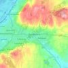
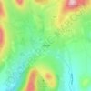
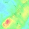
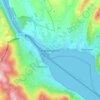
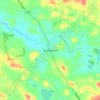
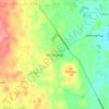
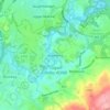
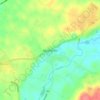
Dollingstown topographic map

Click on the map to display elevation.

About this map

Name: Dollingstown topographic map, elevation, terrain.

Location: Dollingstown, County Down, Northern Ireland, United Kingdom (54.45500 -6.30634 54.46866 -6.28332)

Average elevation: 184 ft

Minimum elevation: 115 ft

Maximum elevation: 226 ft

Other topographic maps

Click on a map to view its topography, its elevation and its terrain.
Dundonald

United Kingdom > Northern Ireland > County Down

Average elevation: 262 ft

Banbridge

United Kingdom > Northern Ireland > County Down

Average elevation: 295 ft

Bangor

United Kingdom > Northern Ireland > County Down

Average elevation: 131 ft

Newry

United Kingdom > Northern Ireland > County Down

Average elevation: 423 ft

Dromara

United Kingdom > Northern Ireland > County Down

Average elevation: 492 ft

Holywood

United Kingdom > Northern Ireland > County Down

Average elevation: 144 ft

Attical

United Kingdom > Northern Ireland > County Down

Average elevation: 509 ft

Dromore

United Kingdom > Northern Ireland > County Down

Average elevation: 348 ft

Ben Crom

United Kingdom > Northern Ireland > County Down

Average elevation: 1,260 ft

Newry

United Kingdom > Northern Ireland > County Down

Average elevation: 240 ft

Scarva

United Kingdom > Northern Ireland > County Down

Average elevation: 184 ft

Gilford

United Kingdom > Northern Ireland > County Down

Average elevation: 141 ft

Killough

United Kingdom > Northern Ireland > County Down

Average elevation: 23 ft

Ardglass

United Kingdom > Northern Ireland > County Down

Average elevation: 712 ft

Kilcoo

United Kingdom > Northern Ireland > County Down

Average elevation: 512 ft

Ballyroney

United Kingdom > Northern Ireland > County Down

Average elevation: 279 ft

Ballygowan

United Kingdom > Northern Ireland > County Down

Average elevation: 220 ft

Bleary

United Kingdom > Northern Ireland > County Down > Bleary

Average elevation: 210 ft

Drumaness

United Kingdom > Northern Ireland > County Down

Average elevation: 243 ft

Ballela

United Kingdom > Northern Ireland > County Down

Average elevation: 446 ft

Moira

United Kingdom > Northern Ireland > County Down

Average elevation: 194 ft

Cloghy

United Kingdom > Northern Ireland > County Down

Average elevation: 26 ft

Balloo

United Kingdom > Northern Ireland > County Down

Average elevation: 128 ft

Millisle

United Kingdom > Northern Ireland > County Down

Average elevation: 33 ft

Carryduff

United Kingdom > Northern Ireland > County Down

Average elevation: 361 ft

Gruggandoo

United Kingdom > Northern Ireland > County Down

Average elevation: 830 ft

Drumbo

United Kingdom > Northern Ireland > County Down

Average elevation: 308 ft

Annahilt

United Kingdom > Northern Ireland > County Down

Average elevation: 341 ft

Rostrevor

United Kingdom > Northern Ireland > County Down

Average elevation: 256 ft

Slieve Muck

United Kingdom > Northern Ireland > County Down

Average elevation: 1,398 ft

Moneyreagh

United Kingdom > Northern Ireland > County Down

Average elevation: 312 ft

Culcavy

United Kingdom > Northern Ireland > County Down

Average elevation: 194 ft

Katesbridge

United Kingdom > Northern Ireland > County Down > Newry

Average elevation: 325 ft

Magheralin

United Kingdom > Northern Ireland > County Down

Average elevation: 177 ft

Bangor

United Kingdom > Northern Ireland > County Down

Average elevation: 131 ft

Newry

United Kingdom > Northern Ireland > County Down

Average elevation: 423 ft

Slieve Donard

United Kingdom > Northern Ireland > County Down

Average elevation: 1,657 ft

Banbridge

United Kingdom > Northern Ireland > County Down

Average elevation: 295 ft

Carryduff

United Kingdom > Northern Ireland > County Down

Average elevation: 361 ft

Kilkeel

United Kingdom > Northern Ireland > County Down

Average elevation: 115 ft

Newry

United Kingdom > Northern Ireland > County Down

Average elevation: 423 ft

Bangor

United Kingdom > Northern Ireland > County Down

Average elevation: 131 ft

Hilltown

United Kingdom > Northern Ireland > County Down

Average elevation: 446 ft

Ballycarn

United Kingdom > Northern Ireland > County Down > Drumbo

Average elevation: 217 ft

Kilkeel

United Kingdom > Northern Ireland > County Down

Average elevation: 115 ft

Gear up for your next adventure:

🧷Carabiner Set - Durable clips for gear attachment
🪶Multi‑Purpose Knife - Useful blade for camp and trail
🧣Hiking Neck Gaiter - Multi‑use neck protection for outdoor weather
🌧️Backpack Rain Cover - Keep gear dry in wet weather
🕶️GPS Smartphone Mount - Secure mount for phone navigation

As an Amazon Associate, this site earns from qualifying purchases at no extra cost to you.