Geolocate

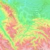
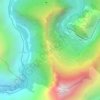
Mosoc Llacta topographic map

Click on the map to display elevation.

About this map

Name: Mosoc Llacta topographic map, elevation, terrain.

Location: Mosoc Llacta, Province of Acomayo, Cusco, Peru (-14.13835 -71.54632 -14.05121 -71.43925)

Average elevation: 12,575 ft

Minimum elevation: 11,234 ft

Maximum elevation: 14,150 ft

Other topographic maps

Click on a map to view its topography, its elevation and its terrain.
Machu Picchu

Peru > Cusco > Machupicchu

Average elevation: 7,306 ft

Province of La Convención

Peru > Cusco

Average elevation: 5,240 ft

Province of Paucartambo

Peru > Cusco

Average elevation: 8,806 ft

Yuncaypata

Peru > Cusco

Average elevation: 12,228 ft

Urubamba

Peru > Cusco

Average elevation: 9,744 ft

Province of Cusco

Peru > Cusco

Average elevation: 11,063 ft

Marcahuasi

Peru > Cusco

Average elevation: 7,999 ft

San Isidro

Peru > Cusco > Compone

Average elevation: 10,502 ft

Zurite

Peru > Cusco > Zurite

Average elevation: 11,558 ft

Patacancha

Peru > Cusco > Patacancha

Average elevation: 13,780 ft

Province of Anta

Peru > Cusco

Average elevation: 10,837 ft

Province of Acomayo

Peru > Cusco

Average elevation: 12,513 ft

Yanama

Peru > Cusco > Santa Teresa

Average elevation: 10,741 ft

Province of Calca

Peru > Cusco

Average elevation: 8,018 ft

Quincemil

Peru > Cusco > Camanti > Quincemil

Average elevation: 2,438 ft

Rio Aquascalientes

Peru > Cusco > Machupicchu > Machupicchu Pueblo

Average elevation: 8,668 ft

Gear up for your next adventure:

🧤Tactile Hiking Gloves - Keep hands warm while operating GPS and smartphone screens
🪑Portable Camp Table - Compact table for campsite meals
🚪Portable Camp Chair - Foldable chair for comfort at camp
🦶Carbon Trekking Poles - Reduce knee impact on steep descents with ultra-light poles
🪑Ultralight Camp Chairs - Portable seating for resting after a long day of mapping

As an Amazon Associate, this site earns from qualifying purchases at no extra cost to you.