
Middle Portal topographic map
Interactive map
Click on the map to display elevation.
About this map
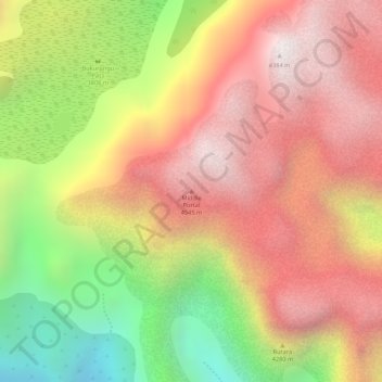
Name: Middle Portal topographic map, elevation, terrain.
Location: Middle Portal, Kasese, Western Region, Uganda (0.39539 29.95203 0.39549 29.95213)
Average elevation: 12,946 ft
Minimum elevation: 10,883 ft
Maximum elevation: 14,364 ft
Other topographic maps
Click on a map to view its topography, its elevation and its terrain.
Kilembe Quarters
Kilembe Quarters, Kasese, Western Region, Uganda
Average elevation: 3,340 ft
Rwenzori Mountains
Rwenzori Mountains, Kasese, Western Region, Uganda
Average elevation: 5,151 ft
Coronation Glacier
Coronation Glacier, South Ridge Route, Kasese, Western Region, Uganda
Average elevation: 14,452 ft
Mount Luigi di Savoia
Mount Luigi di Savoia, South Ridge Route, Kasese, Western Region, Uganda
Average elevation: 13,497 ft