
Shott topographic map
Click on the map to display elevation.
About this map
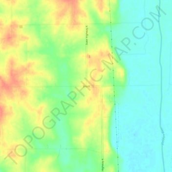
Name: Shott topographic map, elevation, terrain.
Location: Shott, Grundy County, Missouri, United States (40.14223 -93.68078 40.18223 -93.64078)
Average elevation: 817 ft
Minimum elevation: 748 ft
Maximum elevation: 899 ft
Grundy County trails, hiking, mountain biking, running and outdoor activities
Other topographic maps
Click on a map to view its topography, its elevation and its terrain.