Geolocate

Texas topographic map

Click on the map to display elevation.

About this map

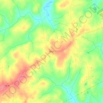
Name: Texas topographic map, elevation, terrain.

Location: Texas, Heard County, Georgia, United States (33.22095 -85.21883 33.26095 -85.17883)

Average elevation: 846 ft

Minimum elevation: 702 ft

Maximum elevation: 991 ft

Heard County trails, hiking, mountain biking, running and outdoor activities

Other topographic maps

Click on a map to view its topography, its elevation and its terrain.

Corinth

United States > Georgia > Heard County

Average elevation: 764 ft

Centralhatchee

United States > Georgia > Heard County

Average elevation: 827 ft

Ephesus

United States > Georgia > Heard County

Average elevation: 1,181 ft

Franklin

United States > Georgia > Heard County

Average elevation: 732 ft

Gear up for your next adventure:

🪑Portable Camp Table - Compact table for campsite meals
🚑Emergency Bivvies - Heat-reflective sleeping bags for survival situations
🌡️Portable Weather Meter - Track weather conditions on the trail
🩳Quick‑Dry Hiking Shorts - Comfortable and quick‑dry shorts for summer hiking
🎒Trail Energy Bars - High‑calorie bars for hiking energy

As an Amazon Associate, this site earns from qualifying purchases at no extra cost to you.