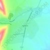
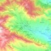
Naftalan topographic map
Click on the map to display elevation.
Naftalan
Naftalan city is located 330 km west of Baku, 50 km from Ganja in the foothills of the Lesser Caucasus Mountains. It's located at an altitude of 225 m above sea level. The spring is warm, the winter is soft here. The average annual temperature is +14.8 degrees. The wind in Naftalan is mainly monsoon. The city's territory is 35.73 km2.
About this map

Name: Naftalan topographic map, elevation, terrain.
Location: Naftalan, 4600, Azerbaijan (40.47232 46.77263 40.52625 46.85326)
Average elevation: 794 ft
Minimum elevation: 476 ft
Maximum elevation: 1,171 ft
Other topographic maps
Click on a map to view its topography, its elevation and its terrain.




Gadabay
Gadabay lies at the northern foot of the Shahdagh Range, at an altitude of 1460 meters, on the coast of the Mis River. The city is located in the middle and high mountainous areas of the Lesser Caucasus (also called Little Caucasus).
Average elevation: 4,934 ft



Shamakhi
Azerbaijan > Shamakhi District
Shamakhi is located in the central part of Shirvan, at an altitude of about 749 m (2,457 ft) above sea level, in a favorable geographical position. In the south of Shamakhi flows to Zongalavay, and in the east Pirsaatchay. The city is surrounded by Binasli, Gushhan from the north, Pirdiraki, and Maiden…
Average elevation: 2,372 ft





Shusha
Shusha (Azerbaijani: Şuşa, (listen)) or Shushi (Armenian: Շուշի) is a city in Azerbaijan, in the region of Nagorno-Karabakh. Situated at an altitude of 1.4–1.8 kilometres (4,600–5,900 ft) in the Karabakh mountains, the city was a mountain resort in the Soviet era.
Average elevation: 4,108 ft




Tovuz
The ancient village of Goytepe (Göy Tepe) is one of the largest archaeological monuments in Ganja – Gazakh region. It is located to the right of the Kura river, 10 km (6.2 mi) east of Tovuz. The site extends over 2 hectares (4.9 acres), at a maximum elevation of around 420 m (1,380 ft).
Average elevation: 1,417 ft

Khyrdalan
Khyrdalan is located in the western part of the Absheron Peninsula, south of the Jeyranbatan Reservoir, between Baku and Sumgait, at an elevation of 71 meters above sea level. It lies just 5 kilometers from Baku and is situated in a seismically active region, with an earthquake intensity of 8 points on the…
Average elevation: 259 ft




Neftchala
Throughout its history, Neftçala has suffered from floods because of its proximity to the river and most of the town's relatively low elevation.
Average elevation: -89 ft




Gazakh
Gazakh region is located in the western part of the republic, in the western part of the vast Ganja-Gazakh plain, which starts from the slopes of the mountain range of the Lesser Caucasus and extends along the right bank of the Kura river. The highest elevation is "Odun" mountain (1316 meters). Its nature is…
Average elevation: 1,234 ft