
曲登乡 topographic map
Interactive map
Click on the map to display elevation.
About this map
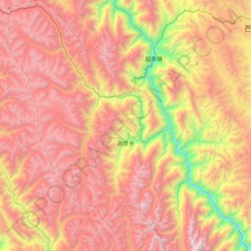
Name: 曲登乡 topographic map, elevation, terrain.
Location: 曲登乡, 芒康县, 昌都市, 西藏自治区, 中国 (29.21880 97.99990 29.74014 98.43897)
Average elevation: 14,324 ft
Minimum elevation: 8,087 ft
Maximum elevation: 19,882 ft
Other topographic maps
Click on a map to view its topography, its elevation and its terrain.