
帮达乡 topographic map
Interactive map
Click on the map to display elevation.
About this map
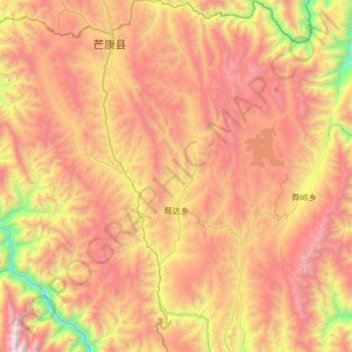
Name: 帮达乡 topographic map, elevation, terrain.
Location: 帮达乡, 芒康县, 昌都市, 西藏自治区, 中国 (29.24605 98.62362 29.74363 98.91341)
Average elevation: 13,363 ft
Minimum elevation: 8,104 ft
Maximum elevation: 18,668 ft
Other topographic maps
Click on a map to view its topography, its elevation and its terrain.