
纳西民族乡 topographic map
Interactive map
Click on the map to display elevation.
About this map
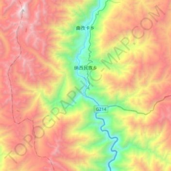
Name: 纳西民族乡 topographic map, elevation, terrain.
Location: 纳西民族乡, 芒康县, 昌都市, 西藏自治区, 中国 (28.90122 98.48063 29.11508 98.75731)
Average elevation: 12,848 ft
Minimum elevation: 7,267 ft
Maximum elevation: 19,012 ft
Other topographic maps
Click on a map to view its topography, its elevation and its terrain.