Geolocate

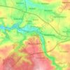
Meissen topographic map

Click on the map to display elevation.

About this map
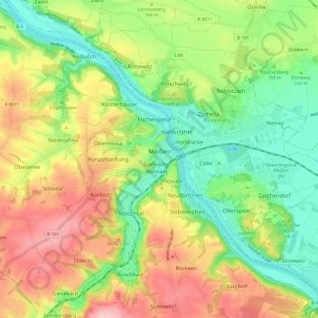
Name: Meissen topographic map, elevation, terrain.

Location: Meissen, Saxony, Germany (51.12927 13.42424 51.19310 13.54170)

Average elevation: 535 ft

Minimum elevation: 279 ft

Maximum elevation: 866 ft

Other topographic maps

Click on a map to view its topography, its elevation and its terrain.
Neurobschütz

Germany > Saxony > Meißen > Robschütz

Average elevation: 673 ft

Nossen

Germany > Saxony > Meißen > Nossen

Average elevation: 896 ft

Meissen

Germany > Saxony > Meißen

Average elevation: 531 ft

Niederstößwitz

Germany > Saxony > Meißen > Käbschütztal

Average elevation: 627 ft

Mauna

Germany > Saxony > Meißen > Käbschütztal > Krögis

Average elevation: 673 ft

Brettmühlenteich

Germany > Saxony > Meißen > Tauscha

Average elevation: 509 ft

Constappel

Germany > Saxony > Meißen

Average elevation: 518 ft

Kleinprausitz

Germany > Saxony > Meißen > Käbschütztal

Average elevation: 666 ft

Gear up for your next adventure:

🚁Photography Drones - Capture stunning aerial views of landforms and topography
🗺️Topographic Maps - Detailed topo maps for hiking, exploring and outdoor navigation
📷Action Camera - Capture your outdoor adventures in HD
🖼️Topo Map Wall Art - Decorative topographic prints of famous peaks and regions
⌚Solar GPS Watches - Advanced multisport watches with built-in topographic maps

As an Amazon Associate, this site earns from qualifying purchases at no extra cost to you.