Geolocate

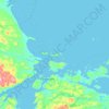
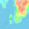
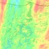
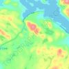
Glovertown topographic map

Click on the map to display elevation.

About this map

Name: Glovertown topographic map, elevation, terrain.

Location: Glovertown, Newfoundland, Newfoundland and Labrador, Canada (48.63500 -54.09178 48.74395 -53.94719)

Average elevation: 187 ft

Minimum elevation: -3 ft

Maximum elevation: 676 ft

Other topographic maps

Click on a map to view its topography, its elevation and its terrain.
Bell Island

Canada > Newfoundland and Labrador

Average elevation: 30 ft

Labrador

Canada > Newfoundland and Labrador

Average elevation: 2,211 ft

Englee

Canada > Newfoundland and Labrador > Englee

Average elevation: 112 ft

Mount Caubvick

Canada > Newfoundland and Labrador

Average elevation: 4,173 ft

Highway 220

Canada > Newfoundland and Labrador

Average elevation: 26 ft

Whitbourne

Canada > Newfoundland and Labrador > Whitbourne

Average elevation: 230 ft

Grosse Point

Canada > Newfoundland and Labrador

Average elevation: 82 ft
Ragged Point

Canada > Newfoundland and Labrador

Average elevation: 20 ft

Bridgeport

Canada > Newfoundland and Labrador

Average elevation: 72 ft

Monroe

Canada > Newfoundland and Labrador

Average elevation: 135 ft

Smokey

Canada > Newfoundland and Labrador > Smokey

Average elevation: 46 ft

Tims Hill

Canada > Newfoundland and Labrador

Average elevation: 413 ft

Gear up for your next adventure:

🪵Folding Camp Saw - Compact saw for wood and campsite work
🥇GPS Hiking Watch - Multi‑sport GPS watch with navigation and trail tracking
🧣Hiking Neck Gaiter - Multi‑use neck protection for outdoor weather
⌚Solar GPS Watches - Advanced multisport watches with built-in topographic maps
🚁Photography Drones - Capture stunning aerial views of landforms and topography

As an Amazon Associate, this site earns from qualifying purchases at no extra cost to you.