
Make a donation
Gear up for your next adventure:
As an Amazon Associate, this site earns from qualifying purchases at no extra cost to you.
Puls topographic map
Click on the map to display elevation.
Make a donation
Gear up for your next adventure:
As an Amazon Associate, this site earns from qualifying purchases at no extra cost to you.
Puls
Die Gemeinde Puls liegt mitten im Naturraum „Hohenwestedter Geest“. Durch die vorwiegend sandigen Böden dieses Geestdorfes hatte der Kiesabbau für die Gemeinde eine besondere wirtschaftliche Bedeutung. Die Farbe Gelb (Gold) im Schildfuß soll daran erinnern. Bedingt durch die Höhenlage von Puls verläuft durch das Gemeindegebiet eine Wasserscheide, dies wird durch die beiden unterbrochenen blauen Wellenfäden symbolisiert. Aufgrund der günstigen Höhenlage hat die Windenergie für Puls eine besondere Bedeutung. Das Windrad verweist auf diese alternative Energiegewinnung.
Make a donation
Gear up for your next adventure:
As an Amazon Associate, this site earns from qualifying purchases at no extra cost to you.
About this map
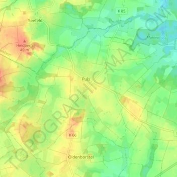
Name: Puls topographic map, elevation, terrain.
Average elevation: 85 ft
Minimum elevation: 16 ft
Maximum elevation: 161 ft
Make a donation
Gear up for your next adventure:
As an Amazon Associate, this site earns from qualifying purchases at no extra cost to you.
Other topographic maps
Click on a map to view its topography, its elevation and its terrain.
Rhinplate und Elbufer südlich Glückstadt
Deutschland > Schleswig-Holstein > Kreis Steinburg > Kollmar
Average elevation: 0 ft
Make a donation
Gear up for your next adventure:
As an Amazon Associate, this site earns from qualifying purchases at no extra cost to you.
Make a donation
Gear up for your next adventure:
As an Amazon Associate, this site earns from qualifying purchases at no extra cost to you.
Springhoe
Deutschland > Schleswig-Holstein > Kreis Steinburg > Hohenlockstedt
Average elevation: 66 ft
Kaaksburg
Deutschland > Schleswig-Holstein > Kreis Steinburg > Kaaks
Über ihre Entstehung und Funktion ist nicht viel bekannt. Der ovale Ringwall mit einem Durchmesser von 80 bzw. 100 m und einer Höhe von ca. 5 m wurde aus dunkler Erde aufgeworfen, während der Boden in der Umgebung sandig ist, weshalb angenommen wurde, dass das Material aus der im Südosten vorbeifließenden…
Average elevation: 36 ft
Make a donation
Gear up for your next adventure:
As an Amazon Associate, this site earns from qualifying purchases at no extra cost to you.
Springhoe
Deutschland > Schleswig-Holstein > Kreis Steinburg > Hohenlockstedt
Average elevation: 66 ft