
Coverack topographic map
Click on the map to display elevation.
About this map
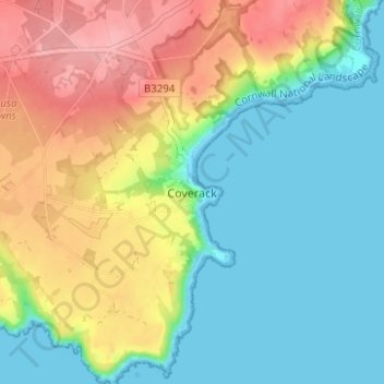
Name: Coverack topographic map, elevation, terrain.
Location: Coverack, Cornwall, England, TR12 6TA, United Kingdom (50.00249 -5.11720 50.04249 -5.07720)
Average elevation: 141 ft
Minimum elevation: 0 ft
Maximum elevation: 364 ft
Other topographic maps
Click on a map to view its topography, its elevation and its terrain.
St. Columb Major
United Kingdom > England > Cornwall
St Columb occupies a plateau at about 300 feet (91 m) elevation. The north part of the town (known as 'Bridge') descends into the Vale of Lanherne, having a minimum elevation of approximately 165 feet (50 m). It was originally a linear settlement built on the main road running north-east to south-west, but…
Average elevation: 361 ft