Geolocate

Fawkham Green topographic map

Click on the map to display elevation.

👉 Easily get elevation data in JSON, GeoTIFF and KML formats using Elevation API
Thank you for supporting this site ❤️
Make a donation

About this map

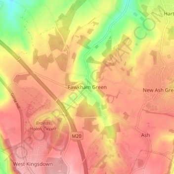
Name: Fawkham Green topographic map, elevation, terrain.

Location: Fawkham Green, Sevenoaks, Kent, England, DA3 8NL, United Kingdom (51.34641 0.25628 51.38641 0.29628)

Average elevation: 410 ft

Minimum elevation: 157 ft

Maximum elevation: 545 ft

Other topographic maps

Click on a map to view its topography, its elevation and its terrain.

Farningham

United Kingdom > England > Kent > Sevenoaks

Average elevation: 292 ft

Eynsford

United Kingdom > England > Kent > Sevenoaks > Eynsford

Average elevation: 341 ft

Kemsing

United Kingdom > England > Kent > Sevenoaks

Average elevation: 456 ft

Darent

United Kingdom > England > Kent > Sevenoaks

Average elevation: 302 ft

Sevenoaks

United Kingdom > England > Kent > Sevenoaks

Average elevation: 417 ft

Penshurst

United Kingdom > England > Kent > Sevenoaks

Average elevation: 217 ft

Westerham

United Kingdom > England > Kent > Sevenoaks > Hosey Hill

Average elevation: 440 ft

Crockenhill

United Kingdom > England > Kent > Sevenoaks

Average elevation: 315 ft

Chiddingstone

United Kingdom > England > Kent > Sevenoaks

Average elevation: 210 ft

Riverhead

United Kingdom > England > Kent > Sevenoaks

Average elevation: 430 ft

Shoreham

United Kingdom > England > Kent > Sevenoaks

Average elevation: 404 ft

Bough Beech Reservoir

United Kingdom > England > Kent > Sevenoaks

Average elevation: 256 ft

Hartley

United Kingdom > England > Kent > Sevenoaks

Average elevation: 325 ft

Fawkham

United Kingdom > England > Kent > Sevenoaks

Average elevation: 354 ft

Cowden

United Kingdom > England > Kent > Sevenoaks

Average elevation: 295 ft

Broke Hill Golf Club

United Kingdom > England > Kent > Sevenoaks > Halstead

Average elevation: 479 ft

West Kingsdown

United Kingdom > England > Kent > Sevenoaks > West Kingsdown

Average elevation: 505 ft

Knockholt

United Kingdom > England > Kent > Sevenoaks

Average elevation: 591 ft

Seal

United Kingdom > England > Kent > Sevenoaks

Average elevation: 384 ft

Hextable

United Kingdom > England > Kent > Sevenoaks > Hextable

Average elevation: 200 ft

Sevenoaks

United Kingdom > England > Kent > Sevenoaks

Average elevation: 417 ft

Sevenoaks

United Kingdom > England > Kent > Sevenoaks

Average elevation: 417 ft

Shoreham

United Kingdom > England > Kent > Sevenoaks

Average elevation: 404 ft

Riverhead

United Kingdom > England > Kent > Sevenoaks

Average elevation: 430 ft

Hever

United Kingdom > England > Kent > Sevenoaks

Average elevation: 213 ft

Eynsford

United Kingdom > England > Kent > Sevenoaks > Eynsford

Average elevation: 341 ft

Seal

United Kingdom > England > Kent > Sevenoaks

Average elevation: 384 ft

Gear up for your next adventure:

📷Action Camera - Capture your outdoor adventures in HD
🌲Outdoor Survival Books - Best books on survival skills
🥾Men's Hiking Boots - Durable, waterproof footwear for rugged terrain and steep inclines
🚗GPS Dash Cams - Record your scenic drives through mountain passes and canyons
🪶LED Camping Lantern - Bright lantern for camp lighting

As an Amazon Associate, this site earns from qualifying purchases at no extra cost to you.