
Batang topographic map
Click on the map to display elevation.
Batang
It is warmer here than most of Tibet (because of the lower altitude) and is reported to be a friendly, easy-going place, surrounded by barley fields. The plain surrounding the town is unusually fertile and produces two harvests a year. The main products include: rice, maize, barley, wheat, peas, cabbages, turnips, onions, grapes, pomegranates, peaches, apricots, water melons and honey. There are also cinnabar (mercury sulphide) mines from which mercury is extracted.
About this map
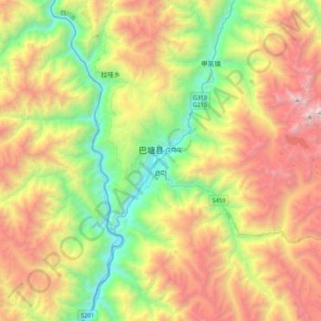
Name: Batang topographic map, elevation, terrain.
Location: Batang, Batang County, Kardze, Sichuan, 627600, China (29.85012 98.95237 30.17012 99.27237)
Average elevation: 12,822 ft
Minimum elevation: 8,110 ft
Maximum elevation: 19,649 ft
Other topographic maps
Click on a map to view its topography, its elevation and its terrain.
Huanglong Scenic and Historic Interest Area
China > Sichuan > Songpan County
Repeated glaciation events, the unique terrane structure, the formation of tufa, the stratum of carbonic acid rock, and climatic conditions such as Arctic-alpine sunlight have created this world-famous travertine landscape. Huanglong covers an area of 700 km2 at an altitude between 1700m and 5588m. Major…
Average elevation: 10,991 ft
Songpan County
Due to its altitude, Songpan has a humid continental climate (Köppen Dwb), with cool winters and warm, rainy summers. The monthly 24-hour average temperature ranges from −3.4 °C (25.9 °F) in January to 14.8 °C (58.6 °F) in July, and the annual mean is 6.28 °C (43.3 °F). The high elevation also results…
Average elevation: 10,830 ft
Garzê County
Due to its elevation, Garzê County has a monsoon-influenced humid continental climate (Köppen Dwb) and subarctic climate, with cold but very dry winters, and warm summers with frequent rain. The monthly 24-hour average temperature ranges from −3.9 °C (25.0 °F) in January to 14.2 °C (57.6 °F) in July,…
Average elevation: 14,045 ft
Hongyuan County
This is the only county under the Prefecture with entirely yak herding pastoralists. The average altitude above the sea level is 3,600 m (11,800 ft). About 8,398 square meter and about 40,000 people reside (2004) mostly Amdo Tibetan. The language is spoken is one of the most conservative dialect among the Amdo…
Average elevation: 12,159 ft
Muli Tibetan Autonomous County
Since 1987, Muli Monastery has been partly restored and now has about eighty young monks in residence. It is near a modern small town called Wachang, located high up on the western edge of the Litang River Valley at about 3000 metres altitude. The other monasteries are Kulu (now known as Kangwu), which has…
Average elevation: 11,122 ft