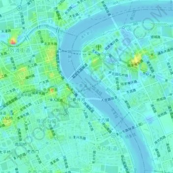
Geolocate

黄浦江 topographic map

Interactive map

Click on the map to display elevation.

About this map

Name: 黄浦江 topographic map, elevation, terrain.

Location: 黄浦江, 浦明路, 洋泾街道, 浦东新区, 上海市, 200007, 中国 (31.21692 121.48627 31.25130 121.50902)

Average elevation: 26 ft

Minimum elevation: -23 ft

Maximum elevation: 161 ft

Other topographic maps

Click on a map to view its topography, its elevation and its terrain.

高东镇

中国 > 上海市 > 浦东新区

高东镇, 浦东新区, 上海市, 中国

Average elevation: 10 ft

高桥镇

中国 > 上海市 > 浦东新区

高桥镇, 浦东新区, 上海市, 200137, 中国

Average elevation: 7 ft

康桥镇

中国 > 上海市 > 浦东新区

康桥镇, 浦东新区, 上海市, 201315, 中国

Average elevation: 13 ft

祝桥镇

中国 > 上海市 > 浦东新区

祝桥镇, 浦东新区, 上海市, 中国

Average elevation: 10 ft

曹路镇

中国 > 上海市 > 浦东新区

曹路镇, 浦东新区, 上海市, 中国

Average elevation: 10 ft

南汇新城镇

中国 > 上海市 > 浦东新区

南汇新城镇, 浦东新区, 上海市, 中国

Average elevation: 3 ft

张江镇

中国 > 上海市 > 浦东新区

张江镇, 浦东新区, 上海市, 中国

Average elevation: 13 ft