
Colony topographic map
Click on the map to display elevation.
About this map
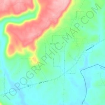
Name: Colony topographic map, elevation, terrain.
Location: Colony, Cullman County, Alabama, United States (33.92320 -86.92763 33.96020 -86.87101)
Average elevation: 466 ft
Minimum elevation: 285 ft
Maximum elevation: 820 ft
Cullman County trails, hiking, mountain biking, running and outdoor activities
Other topographic maps
Click on a map to view its topography, its elevation and its terrain.