
Fairview topographic map
Click on the map to display elevation.
About this map
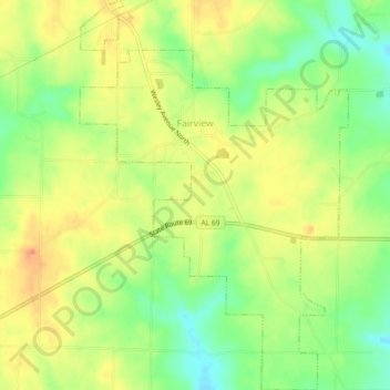
Name: Fairview topographic map, elevation, terrain.
Location: Fairview, Cullman County, Alabama, United States (34.22954 -86.70157 34.26725 -86.67008)
Average elevation: 922 ft
Minimum elevation: 820 ft
Maximum elevation: 1,014 ft
Cullman County trails, hiking, mountain biking, running and outdoor activities
Other topographic maps
Click on a map to view its topography, its elevation and its terrain.