Geolocate

Garland topographic map

Click on the map to display elevation.

About this map

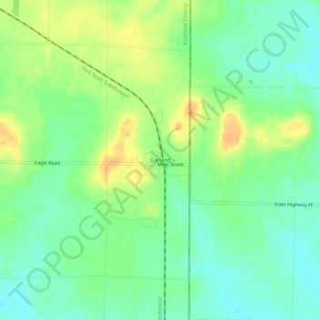
Name: Garland topographic map, elevation, terrain.

Location: Garland, Bourbon County, Kansas, 66741, United States (37.71171 -94.64246 37.75171 -94.60246)

Average elevation: 850 ft

Minimum elevation: 801 ft

Maximum elevation: 919 ft

Bourbon County trails, hiking, mountain biking, running and outdoor activities

Other topographic maps

Click on a map to view its topography, its elevation and its terrain.

Mapleton

United States > Kansas > Bourbon County

Average elevation: 876 ft

Redfield

United States > Kansas > Bourbon County

Average elevation: 863 ft

Fulton

United States > Kansas > Bourbon County

Average elevation: 827 ft

Bronson

United States > Kansas > Bourbon County

Average elevation: 1,060 ft

Gear up for your next adventure:

🪵Folding Camp Saw - Compact saw for wood and campsite work
🦶Carbon Trekking Poles - Reduce knee impact on steep descents with ultra-light poles
🔭Telescopic Hiking Pole - Adjustable pole for hiking stability
📱Heavy-Duty Phone Cases - Drop-proof and waterproof protection for outdoor navigation
🏕️Tent Footprint - Protect your tent base from wear

As an Amazon Associate, this site earns from qualifying purchases at no extra cost to you.