Geolocate

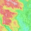
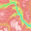
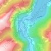
Gudbrandsdalen topographic map

Click on the map to display elevation.

About this map

Name: Gudbrandsdalen topographic map, elevation, terrain.

Location: Gudbrandsdalen, Norway (61.10546 9.11618 62.05439 10.44828)

Average elevation: 3,133 ft

Minimum elevation: 400 ft

Maximum elevation: 7,037 ft

Other topographic maps

Click on a map to view its topography, its elevation and its terrain.
Norway

Norway

Norway's topography is defined by its rugged and varied terrain, shaped by ancient geological processes and glacial activity. Dominating the landscape are the Scandinavian Mountains, which run through the country and include peaks like Galdhøpiggen, the highest in Northern Europe at 2,469 meters (8,100 feet).…

Average elevation: 469 ft
Oslo

Norway > Oslo

Average elevation: 610 ft

Svalbard

Norway

Average elevation: 151 ft

Tromsø

Norway > Troms

Outside the city, large areas in the municipality are at some altitude and above the treeline with an alpine tundra climate (ET). The islands to the west at the outer seabord are milder in winter like Måsvik, making this part of the municipality a subpolar oceanic climate (Cfc) zone. The average date for…

Average elevation: 633 ft

Scandinavian Mountains

Norway > Innlandet

The mountain chain's highest summits are mostly concentrated in an area (of mean altitude of over 1,000 m) between Stavanger and Trondheim in South Norway, with numerous peaks over 1,300 m and some peaks over 2,000 m. Around Trondheim Fjord, peaks decrease in altitude to about 400–500 m rising again to…

Average elevation: 6,726 ft

Lofoten

Norway > Nordland

Average elevation: 761 ft

Bergen

Norway > Vestland

Average elevation: 410 ft

Longyearbyen

Norway

Average elevation: 594 ft

Norway

Norway

At 385,207 square kilometres (148,729 sq mi) (including Svalbard and Jan Mayen; 323,808 square kilometres (125,023 sq mi) without), much of the country is dominated by mountainous or high terrain, with a great variety of natural features caused by prehistoric glaciers and varied topography. The most noticeable…

Average elevation: 469 ft

Tvedestrand

Norway > Agder

Average elevation: 259 ft

Finsland

Norway > Agder

Average elevation: 1,001 ft

Hatløya

Norway > Møre og Romsdal > Ulsteinvik

Average elevation: 0 ft

Stjørdal

Norway > Trøndelag

Average elevation: 1,030 ft

Edgeøya

Norway

Average elevation: 279 ft

Stavanger

Norway > Rogaland

The municipality of Stavanger is located in a coastal landscape, bordering the sea to the west and Boknafjorden in the northeast. The Byfjorden and Gandsfjorden run along the east side of the city. It is part of the Low-Jæren, a flat area of land consisting mostly of marsh, sand, and stone aur, that ranges…

Average elevation: 144 ft

Neverdal

Norway > Nordland

Average elevation: 351 ft

Trondheim

Norway > Trøndelag > Trondheim

Trondheim is situated where the River Nidelva meets Trondheim Fjord with an excellent harbour and sheltered condition. The river used to be deep enough for most boats in the Middle Ages. An avalanche of mud and stones made it less navigable and partly ruined the harbour in the mid-17th century. The…

Average elevation: 387 ft

Mistberget

Norway > Akershus

Average elevation: 1,526 ft

Bøler

Norway > Akershus > Leirsund

Average elevation: 489 ft

Nomeland

Norway > Agder > Valle

Average elevation: 1,772 ft

Stranda

Norway > Møre og Romsdal

Average elevation: 341 ft

Raundalselvi

Norway > Vestland

Average elevation: 2,303 ft

Luravika

Norway > Rogaland > Sandnes

Average elevation: 59 ft

Nordfjord

Norway > Nordland

Average elevation: 810 ft

Ljørdalen

Norway > Innlandet

Average elevation: 1,591 ft

Øverleitet

Norway > Nordland > Ramberg

Average elevation: 253 ft

Refsholt

Norway > Vestfold > Ula

Average elevation: 52 ft

Ferdinandbreen

Norway

Average elevation: 1,549 ft

Oslo

Norway

The lake's altitude above sea level is 183 metres. The water is in a popular hiking area. Near the water itself, it is great for barbecues, swimming, beach volleyball and other activities.

Average elevation: 764 ft

Bagn

Norway > Innlandet

Average elevation: 1,516 ft

Ullensaker

Norway > Akershus

Average elevation: 594 ft

Nordre Roset

Norway > Innlandet

Average elevation: 840 ft

Hopen

Norway

Average elevation: 26 ft

Nipa

Norway > Vestland

Average elevation: 3,471 ft

Nipa

Norway > Vestland

Average elevation: 3,471 ft

Hasvik

Norway > Finnmark

Average elevation: 177 ft

Nygård

Norway > Vestland > Måløy

Average elevation: 427 ft

Oslo

Norway

The lake's altitude above sea level is 183 metres. The water is in a popular hiking area. Near the water itself, it is great for barbecues, swimming, beach volleyball and other activities.

Average elevation: 764 ft

Forr

Norway > Trøndelag

Average elevation: 148 ft

Ålesund

Norway > Møre og Romsdal

Average elevation: 299 ft

Valldal

Norway > Møre og Romsdal

Average elevation: 581 ft

Ramsvik

Norway > Møre og Romsdal

Average elevation: 207 ft

Storåsen

Norway > Vestland > Bergen

Average elevation: 417 ft

On south island

Norway > Nordland > Å > Tind

Average elevation: 144 ft

Kårstad

Norway > Innlandet

Average elevation: 1,821 ft

Svullrya

Norway > Innlandet > Grue Finnskog > Sæterbakken

Average elevation: 932 ft

Rondane National Park

Norway

Rondane National Park (Norwegian: Rondane nasjonalpark) is the oldest national park in Norway, established on 21 December 1962. The park is located in Innlandet county, in the municipalities of Dovre, Folldal, Sel, Nord-Fron, Sør-Fron, Stor-Elvdal, and Ringebu. The park contains ten peaks above 2,000 metres…

Average elevation: 3,632 ft

Lindesnes

Norway > Agder

Average elevation: 446 ft

Bodø

Norway > Nordland

Snow cover during winter varies, and is often sparse or lacking in the city center, while being more reliable only slightly inland or at some altitude. The largest recorded snow depth at the airport is 90 centimetres (35 in) in February 1976. Located on a peninsula in the Norwegian Sea, Bodø is known to be a…

Average elevation: 243 ft

Pillarguri

Norway > Innlandet > Otta

Average elevation: 1,903 ft

Nannestad

Norway > Akershus

Average elevation: 1,086 ft

Hove

Norway > Agder

Average elevation: 30 ft

Skien

Norway > Telemark

Average elevation: 577 ft

Oslo

Norway

The lake's altitude above sea level is 183 metres. The water is in a popular hiking area. Near the water itself, it is great for barbecues, swimming, beach volleyball and other activities.

Average elevation: 764 ft

Vardø

Norway > Finnmark

Average elevation: 161 ft

Aukland

Norway > Rogaland

Average elevation: 141 ft

Rosendal

Norway > Vestland

Average elevation: 522 ft

Ballstad

Norway > Nordland

Average elevation: 157 ft

Tennes

Norway > Troms

Average elevation: 174 ft

From

Norway > Vestfold > Sandefjord

Average elevation: 157 ft

Lofoten

Norway

Average elevation: 85 ft

Strandsætra

Norway > Innlandet

Average elevation: 2,562 ft

Greåker

Norway > Østfold

Average elevation: 92 ft

Mærk

Norway > Trøndelag

Average elevation: 1,309 ft

Gaustågrende

Norway > Telemark > Miland

Average elevation: 2,126 ft

Berlevåg

Norway > Finnmark

Average elevation: 394 ft

Evenstad

Norway > Innlandet

Average elevation: 1,175 ft

Ringsaker

Norway > Innlandet

Average elevation: 1,549 ft

Kvernes

Norway > Møre og Romsdal

Average elevation: 102 ft

Etne

Norway > Vestland

Average elevation: 2,306 ft

Tønsberg

Norway > Vestfold

Average elevation: 125 ft

Fossum

Norway > Akershus > Sørumsand

Average elevation: 492 ft

Forneset

Norway > Nordland

Average elevation: 846 ft

Bergen

Norway > Vestland

Average elevation: 410 ft

Gammelskolla

Norway > Innlandet

Average elevation: 2,595 ft

Hardangerfjord

Norway > Vestland

Average elevation: 135 ft

Levanger

Norway > Trøndelag

Average elevation: 144 ft

Nesbyen

Norway

Average elevation: 2,762 ft

Bykle

Norway > Agder

Average elevation: 3,419 ft

Norway

Norway

Norway's topography is defined by its rugged and varied terrain, shaped by ancient geological processes and glacial activity. Dominating the landscape are the Scandinavian Mountains, which run through the country and include peaks like Galdhøpiggen, the highest in Northern Europe at 2,469 meters (8,100 feet).…

Average elevation: 469 ft

Alta

Norway > Finnmark

The town of Alta and most of the municipality is located just below the 70th latitude and is closer to the North Pole than it is to much of Central Europe and the British Isles. The town is the northernmost settlement of urban significance in the European Economic Area, with municipalities north of Alta being…

Average elevation: 1,220 ft

Gilja

Norway > Rogaland

Average elevation: 1,217 ft

Sand

Norway > Akershus > Skui

Average elevation: 545 ft

Nesbyen

Norway > Buskerud

Average elevation: 2,762 ft

Elverum

Norway > Innlandet

Average elevation: 768 ft

Austbygdi

Norway > Vestland

Average elevation: 853 ft

Vindstad

Norway > Nordland > Moskenes

Average elevation: 476 ft

Nordreisa

Norway > Troms

Average elevation: 1,916 ft

Vidmyr

Norway > Agder > Hovden

Average elevation: 3,015 ft

Kårstad

Norway > Innlandet

Average elevation: 1,821 ft

Odda

Norway > Vestland

Average elevation: 2,503 ft

Mannen

Norway > Vestland

Average elevation: 3,510 ft

Gyland

Norway > Agder

Average elevation: 902 ft

Flåm

Norway > Vestland > Flåm

Average elevation: 1,601 ft

Andøy

Norway > Nordland

Average elevation: 102 ft

Inndyr

Norway > Nordland

Average elevation: 220 ft

Mjøsa

Norway

Average elevation: 1,375 ft

Andøya

Norway

Average elevation: 115 ft

Ålfotbreen

Norway > Vestland

Average elevation: 3,789 ft

Gear up for your next adventure:

🔭Telescopic Hiking Pole - Adjustable pole for hiking stability
🔋Solar Power Banks - Keep your GPS and phone charged in remote wilderness areas
💧Water Purification System - Clean water on the trail with reliable purifiers
🧤Tactile Hiking Gloves - Keep hands warm while operating GPS and smartphone screens
🧭Hiking Compass - Precision compass for reliable navigation in the wilderness

As an Amazon Associate, this site earns from qualifying purchases at no extra cost to you.