Geolocate

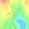
Lodokejek ward topographic map

Click on the map to display elevation.

About this map

Name: Lodokejek ward topographic map, elevation, terrain.

Location: Lodokejek ward, Samburu Central, Samburu, Kenya (0.72721 36.69013 1.05156 37.00101)

Average elevation: 5,673 ft

Minimum elevation: 3,711 ft

Maximum elevation: 7,451 ft

Other topographic maps

Click on a map to view its topography, its elevation and its terrain.

Maralal

Kenya > Samburu > Samburu Central > Maralal ward

Average elevation: 6,417 ft

Maralal

Kenya > Samburu > Samburu Central > Maralal ward

Average elevation: 6,417 ft

Kisima

Kenya > Samburu > Samburu Central > Lodokejek ward

Average elevation: 5,879 ft

Gear up for your next adventure:

🛡️Insect Repellent - Protection against bugs during outdoor activities
🪶Trail Camera - Capture wildlife on your hikes
🗺️Topographic Maps - Detailed topo maps for hiking, exploring and outdoor navigation
🔭Telescopic Hiking Pole - Adjustable pole for hiking stability
🌄Hiking Binoculars - Compact binoculars for scenic views and trail spotting

As an Amazon Associate, this site earns from qualifying purchases at no extra cost to you.