
差那乡 topographic map
Interactive map
Click on the map to display elevation.
About this map
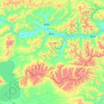
Name: 差那乡 topographic map, elevation, terrain.
Location: 差那乡, 吉隆县, 日喀则市, 西藏自治区, 中国 (28.88520 85.45012 29.26042 86.15770)
Average elevation: 16,293 ft
Minimum elevation: 14,426 ft
Maximum elevation: 21,125 ft
Other topographic maps
Click on a map to view its topography, its elevation and its terrain.